Feeds:
Posts
Comments

Getting Underground

Bruce Rogers, a geologist and cave explorer from since he was a teen, came to us in September of 2015 to talk to us about caves. This was our last talk at the Exploratorium this year. The talk got off to a rocky start with not one but two fire alarms going off! We only had to evacuate once, but we were impressed by how many people (easily 90%) stuck it out.

Bruce starting with a definition of caves as underground, naturally occurring, with some parts in darkness, and humanly accessible. They have fascinated humans since probably long before we were even “human” (if the recent cave findings in South Africa have any bearing). For us they represent beauty, danger, and adventure, where of course for a long time they were likely refuges and homes.

Beyond that, to science and wider human interest they are even more interesting — they are geological repositories, they are workshops of evolution, they are archaeological sites, and holders of cultural treasures.

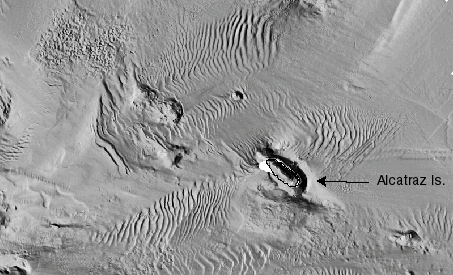
California has a few different types of caves across its landscape: limestone/marble caves, tafoni wind caves (tafoni is an italian word for small grottos built overlooking the ocean), sea caves, and fissure caves.

The ecology of caves can often be novel and fascinating, with new species often being described when new caves are found. Microbiology provides another level of this — with astrobiologists of late showing great interest in finding how life can live on in places like this, and where we might expect to find things alive on places like Mars.

There are creatures like the California giant salamander, one of the few salamanders to make noise. And of course bats — which Bruce in his cave explorations is careful not to disturb.

One cave near Monterey bay contained a graveyard of skunks, the skeletons of several thousand were found there in 1942. The skunks no longer seem to come back, but there are bats still in the cave. Mountain lions make use of caves in Big Basin.

Of course, all these caves are fragile, and their conservation is always a concern. He showed one example of cave that was discovered in 1954 (through an accident where someone got stuck, it soon became widely known) by 2007 everything had been broken off, the floors sledgehammered, full of garbage, and walls of graffiti. Spelunkers are now pretty wary of telling people of their finds, and recent caves opened to the public go to great lengths to preserve them from the outside. Caves do not renew — or at least not on any timescale we live on.

Sea caves are by far the most common type of cave in the Bay Area, created by the impact of waves along the bases of cliffs. Waves bring a tremendous amount of force to bear on cliffs. During hurricanes it can be enough to bend steel and smash concrete — but even a normal wave brings a lot more pressure to bear than most human activity.

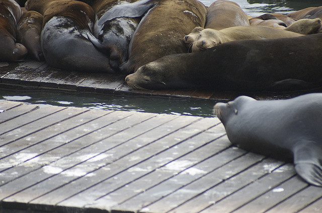
Sea caves can be full of life, fish, seaweed, snails, limpets, anemones, mussels, barnacles, abalone, sea stars, sea lions (seals apparently don’t like caves). They can also be full of sand — the season, tide, and wave action can completely change a cave (he showed one picture of a cave with people standing upright in, and the next was someone crawling through the sand).

If you have an inclination to visit one — be wary! Be careful about the tide, and only go at extremely low tides.

There may be things to discover as well — At least there was… in 1927, a couple recovered some stolen silver in one of the sea caves. A stash of stolen goods from Hotels through San Francisco.

The Farallones also have some caves, quite large ones, with endemic species of a cave cricket and a salamander, and some very uncommon stalactites, and beautiful flowstone.

The only fissure cave he talked about is now on private land. There are not many limestone caves in the region either. The other most common cave type you will find in the Bay Area are tafoni caves — Castle Rock State Park have good examples, as well as Mt Diablo, and the Vasco Caves. The Vasco caves are part of a closed preserve: they have some 2000-4000 year old cave paintings and rare wildlife and plant species. You can get naturalist led tours of it in Spring and Fall.

If you want to know more about caves, preserving and exploring them, Bruce pointed us towards http://caves.org/

Brenda Goeden of BCDC and Ian Wren SF Bay Keepers joined us on August 19th, 2015 at the Exploratorium to to talk about what gets dredged out of the San Francisco Bay.

Most of the dredging that goes on in the bay is for navigation. This is mostly through mud — 80% of the Bay is fine grain mud, and it is dug out to allow deep draft vessels to come through, and keep waters by marina’s clear. The dredging aka mining of sand is mainly for the construction industry – it becomes cement, asphalt, road-base, sub-base and general fill. The grains of sand are grains (.002 to .08 inches in diameter) bigger than mud, and smaller than gravel. it gets mined on demand, not necessarily day in, day out.

There are two main areas whether the sand comes from: Suisun Bay and the Central Bay. Suisun Bay is a finer grain of sand which is often used for back fill in trenches. The coarser sand of the the Central Bay is used for cement. Sand is only found in the high flow areas of the Bay where the water has enough energy to carry the sand. Mud is taken out to the slow wide sides of the Bay.

Sand Flow in the Bay - Barnard et al. 2013

Sand is important for a number of reasons outside of its commercial uses — it helps build marshes and beach. It provides shoreline protection as it takes more energy to move, it provides a particular kind of habitat, and on the shore provides a place for recreation and having a place for viewing wildlife.

The amount of historical sand, and sand in the Bay is difficult to measure. Most of the sand in the Bay comes from the Delta and the larger watershed (40% of California’s watershed drains into the Bay), and estimated 1.2million cubic yards, with another 300+ thousand cubic yards coming from local streams. Where not blocked, the rivers and creeks, slide and bounce the sand along into the Bay.  Storms and other high flow events are key in moving the sand along and into the Bay and beyond.

The sand also is carried out into the ocean, and large dune field lays under water past the Golden Gate Bridge. This was once a wide delta of sand, but has been slowly growing smaller. This changing shape of this sand has affected how sand flows both inside and outside the Bay. The pattern of sand dispersal on Ocean Beach has meant the northern end of the beach has been gaining sand, and the southern has been losing sand leading to fast erosion of the shore. The bay itself is also losing some protection from ocean waves in this process as well. Crissy field on the other hand has benefited, gaining sand from both flows headed out to sea, and sand coming in along the shore.

There’s not a lot known about the habitat underwater in these sands. The Central Bay sand area is the deepest in the Bay 90′-300′ deep where the water is salty, deep, cold, and fast. Aka difficult to study (there has been some studies monitoring what is brought up by the sand miners). We know there are wondrous things going on down there, like the migration of Dungeness crabs — marching in to lay eggs, and then marching out again — but no one has ever seen it or knows the pathways.

Suisun Bay is shallower, warmer, and less salty. The two areas are pretty different, but in both cases these are deserts compared to the meadows of mud. The organisms living there tend to be smaller, efficient, and highly adapted.

Humans have had a huge impact on these fields of sand — the biggest being the pulse of sand brought down from the Sierra’s by gold miners, and estimated 10x the usual flow of sand. Before that, and before many of the rivers and streams were dammed. The flow might have been around 2 million cubic yards. The sand from mining continued to pulse through the system and is only recently pretty much all gone. Now a large portion of the pool of possible erodible materials is trapped behind dams and the delta tunnels.

We still have sand, and we still have sand coming in, but the question now is how much sand do we have, and how much can we afford to take out. Mining has been happening since the 30s, peaking in the years 1949-79. Much of the sand is used locally shipped to different dispersal points around the Bay.

Dredge mud goes to different places, a lot gets shipped and dumped out at sea, or dumped at certain disposal sites in the Bay itself (inside the bay this can disperse contaminants, cause turbidity). These are not the preferable options — that favored option (by BCDC) is helping restoration efforts, filling land that has sunk below sea level on the other side of levees. This is the unfortunately the most expensive option, which there are not a lot of funds for, and small marinas don’t tend to have funds to support that kind of work, and dredging for ports is an expensive enough business that any additional fees would likely be too onerous.

San Francisco Bay Keeper is involved in the issue, hoping to bring in the perspective of the overall health of the Bay and nearby waters, and the sand being an important part of it. The sand taken is not replenished, there is a net loss, and they want to make sure we keep relic sites, and keep mining more in active parts of the flow. They are also looking to insure there is proper compliance and that companies don’t end up taking more than they should. They are looking through commenting on proposals and active litigation to reduce the amount of sand mining going on — to being sand mining to a sustainable level.

On the flip side, if local industries turned to external sources for sand, there may be equally damaging impacts — leaving aside where the sand is being mined from, the carbon costs of shipping that sand by barge or truck would not be small.

The biggest question we seemed all left with was the complicated nature of the question. A unknown or at least unseen, but super valuable resource here in the Bay below us. How much is there? and how much can we afford to take out?

SF Bay Area Caves: A Ramble Through the Underground Realm
Guest Speaker: Bruce Rogers
7pm Wednesday, September 23rd, 2015 (doors open 6:30pm)
FREE at the Exploratorium Bay Observatory Gallery (see directions at the bottom for details)
and please let them know if you are coming.

Bruce Rogers will give us a scientist and explorer’s insight into selected caves of the Greater San Francisco Bay Region. The region is not noted for its abundance of known stygian sites, but they aren’t absent. Some you can visit and some you’ll likely never see for yourself, given the restricted access. We’ll include a quick look into the multitude of sea caves (some of national importance); tafoni shelters (a few with fascinating cultural and natural history); unusual caves comparable to only a few other locations world-wide; and even a scattering of small limestone caves and their unique inhabitants. Discussion will also touch on cultural and architectural sites resembling natural caves.

Elephant Bay Entrance, El Reyes Cave

Elephant Bay Entrance, El Reyes Cave

Bruce Rogers began cave exploring in the wilds of New England in 1958. Since then he has explored the basements of North America from the Atlantic to the Pacific and from Alaska to the Guatemala border in addition to many of the island nations of the Pacific Basin. All facets of geology and geography, cartography, photography, and history are included in his spelean interests. Author and/or editor of several books and scores of articles on caves, his current interests are lava tubes, littoral caves, cave history, and Pleistocene fossils in California caves. His interest in speleology led to formal geologic education and to a position as a field geologist at the USGS. There, he also indulged both artistic and scientific bents as a scientific illustrator and web person at the USGS for a third of a century. Since 2007, he has been writing prolifically and is President of the Western Cave Conservancy.

RESERVATIONS AND DIRECTIONS

Reservations can be made at reserve@exploratorium.edu or 415-528-4444 option 5.

Please let the Gallery know if you are coming.

The lecture will be at the Exploratorium Bay Observatory Gallery at the back of the museum. The special event entrance is through the gate on the outside of building, past the main entrance (as depicted in the map). Someone should be out front helping guide (the museum itself will not be open). Please visit the Exploratorium website for directions to the museum.

Special_Event_Entrance

Joel speaking at the Exploratorium

Joel spoke at the Exploratorium on July 15th, 2015 exploring in conversation and images “Seep City” – a catalog of water discoveries in the city of San Francisco.

Joel’s map of Seep City shows today’s landforms, but overlays the springs, water, and waterways of the past (I like how the map is a lacking in any streets — makes it funner to try and identify the places you know). Crissy field used to be much larger (the current marsh is a “sculpture of a marsh”), and there were large marshes on the eastern side of the city, a tidal waterway running up to the Mission District, and Islais creek wending it’s way into the peninsula. The sands also held many temporary lakes and water ways that would come and go with storms (and the shifting sands). They are barriers and dams, but could be blown away in a storm. Creeks flowing out of the dunes were often temporary or seasonal.

San Francisco — unlike a lot of cities — is not built on a river, and a question you might ask is why we have these seeps and springs at all. If you stripped all our human construction and put back features we’ve flattened or otherwise shaped, you’d find a lot of sand, as well as some serpentite and chert. Before all of our hardscape, rainwater would have been absorbed by sand and passed underneath it, but there is also water coming out of the tops of hills despite the drought. Joel still has yet to answer the question where this exactly comes from.

There were someplaces the water always flowed. The Ohlone, not a stone age people, but perhaps better described as people of the fabric age, made use of water based technology and had daily rituals washing in the creeks here. But there were only a few hundred there when the Spanish arrived.

The Spanish built their settlements in San Francisco around a couple of springs, in the Presidio and in the Mission. Captain Anza noted the spring that flowed out of the dunes near where the Mission was to be built was enough for a larger water wheel.

As the city developed, San Francisco used local water for laundries and for bottling, water was brought around the city through flumes built by private companies selling water to the more settled regions of the city. Lobos creek was one of the sources the flume running along the coast. Another had a water works that created stow lake. Safeway in the Mission/Castro area used to be a reservoir with water pumped over the hills from outside of San Francisco. Tank hill had a tank of water.

Water was also stored around the city for fighting the frequent fires of San Francisco’s early days. You may see the circle and square bricks circling intersections of San Francisco Streets. These continue to hold water for fighting fire.

Most of our water no comes from outside of San Francisco. The Presidio gets 80% of its water from its own springs. And lot of that water still flows, just mostly out of sight, channelized and covered over. There are of course many more water features now in the way of fountains and reservoirs, and some of that come from local water. The fountain in UN plaza (7 piles of stone representing the 7 continents apparently) actually runs on ground water that people refered to as Hayes Creek. BART has to pump water of its tunnels continually. Water runs under the Armory building in the Mission. There is a brewery at Haight and Steiner which hope to use the water underneath their store. The presidio has a creek you can shut it off in 3 places in case someone falls in.

This map is of course just a start, there are seeps and springs all over the city, and while this map holds many — Joel continues to hear of new possible springs and seeps. Keep up to date with this project at his website: seepcity.org

Understanding Sand Mining in SF Bay
Guest Speakers: Brenda Goeden and Ian Wren
7pm Wednesday, August 19th, 2015 (doors open 6:30pm)
FREE at the Exploratorium Bay Observatory Gallery (see directions at the bottom for details)
and please let them know if you are coming.

Sand mining in San Francisco Bay is a little known industry that has existed since the early part of the 20th century. Come learn about this activity that occurs in the deep subtidal areas of the Bay and provides sand for construction projects throughout the Bay Area. The talk will include some of the latest science, a discussion of mining effects on the marine environment and outer coast beaches, and a look at known concerns about sand mining. Ten-year permits for mining have recently been issued, so it’s a great time to understand the efforts and advances being made in the science and industry of local Bay sediments.

snippet of USGS relief map of part of SF Bay

Ian Wren is the Staff Scientist for San Francisco Baykeeper, which works to maintain a healthy ecosystem for wildlife and Bay Area communities. Ian is a hydrologist and works primarily on issues of stormwater, sediment management, nutrients and sea level rise. He has been involved in advocacy and litigation over impacts associated with sand mining and dredging and believes sustainable sediment management is critical to maintaining a thriving Bay ecosystem and economy in the 21st century.

Brenda Goeden is the Sediment Program Manager at the San Francisco Bay Conservation and Development Commission (BCDC). She supervises implementation of dredged sediment strategies. She works in collaboration with the regulatory and resource agencies in the Bay Area. Her work involves both site placement and quality testing. The BCDC was the first Coastal Zone Management Agency in the nation. They regulate Bay Fill and development, aiming to provide maximum feasible public access to the Bay.

RESERVATIONS AND DIRECTIONS

Reservations can be made at reserve@exploratorium.edu or 415-528-4444 option 5.

Please let the Gallery know if you are coming.

The lecture will be at the Exploratorium Bay Observatory Gallery at the back of the museum. The special event entrance is through the gate on the outside of building, past the main entrance (as depicted in the map). Someone should be out front helping guide (the museum itself will not be open). Please visit the Exploratorium website for directions to the museum.

Special_Event_Entrance

Lauren Rust spoke with us on June 30th at Green Apple Books. She came to talk to us about her work at the Marine Mammal Center, the research they do, and the animals they attempt (and don’t attempt) to rescue.

The Center covers 600 miles of California Coast from Mendocino down to around San Luis Obispo. They care for around 500 animals/year. They might stay up to six months, but usually an animal’s stay is a few weeks to 3 months. 50% are released and 50% end up dying or being euthanized, a few end up in zoos (healthy animals that otherwise can’t be released, for instance if they were blind). They have a big pool for cetacean’s like dolphin’s but usually they serve as triage pass them on to others for longer care.

Their most common animals are California Sea Lions, Harbor Seals, and Elephant Seals. Guadalupe and Northern Fur Seals, and Stellar Sea Lions are less common to the Center.

The number of animals they have taken care of over the years has grown since their start in 1975. Their peak year thus far was in 2009 when their new facility coincided with an outbreak. 2015 is close to those numbers and will likely surpass it.

The reason for that is the large numbers of starving young sea lions washing up on California shores. The reason for this influx is water temperature — a patch of warm water known as “the blob” that has been bobbing off the coast of California since 2013 and is now hugging it. The effect of that water has been to inhibit upwelling, which means less phytoplankton, which means less zooplankton, which means less fish, which means… problems for sea lions.

California Sea Lions have taken the biggest hit because of a number of reasons. Although they range the whole western coast of the U.S. down along Mexico, they give birth in only a limited number of rookeries the furthest north being the Channel Islands.

77% of breeding females give birth each year to a pup (they are polygnous with one male to many females) and gestate for 9 months. The mother spends the first few days ashore with their ~7kg babies but then start to make foraging trips, finding their pups by vocalization when they return to shore. The mother nurses them for 6-11 months. It’s not easy being a seal mom!

What happens with this is that the warm water, having kept the fish away, keeps the mother further and further away from her pups. Eventually the pups take to the water, seeking food, and then wash up malnourished onto mainland shores (the vast bulk unsuprisingly were in Santa Barbara). This started happening in Dec of this year — in a normal year a pup would have been nursed through May. Researchers on the Channel islands have seen lower birth rates and mothers having a harder time catching food.

600 pups have been admitted, given fish milkshakes as well as subcutaneous fluids with suppliments and anti-parasites (sea lions typically have parasites they have picked up from fish, so they try not to treat them too much). Eventually they are worked up to food, and one of their conditions of release is that they eat free food.

One lesson learned this year given the numbers of malnourished patients, not giving the pups too much — spaing it out or just giving less. It sometimes takes the pups a while to figure out what to do with fish. They’ll drag a fish on a line to simulate swimming (most the of the fish is frozen), or sometimes drop a live fish in to simulate.

Once they’ve gained weight, have clean bloodwork, and eat alongside others, they get a flipper tag and are released (sea lion pups are usually taken south, seals are relased near chimney rock on Point Reyes — never on a public beach — and elephant seals where there are rookeries).

Elephant Seals and Harbor Seals tend to be much younger patients, from premies to a few days old, and require a bit more attention and time at fish school (the california sea lions often have some experience with fish in the wild).

Other reasons for the mass strandings this year have been considered, radiation, ocean health, contaminants, and other human interactions, but other marine mammal species have not been equally affected and the big problem has been with pups. Elephant Seals and Harbor Seals have different life cycles, both with much shorter periods to nurse.

Malnutrition is what brings most patients into the Center, the next leading cause of strandings is Domic Acid Toxicity. This is cause by the algae of red tides, which is eaten by fish, and then by sea lions. Its effects in sea lions are memory loss, brain damage, reproductive failure, and seizures similar to epilepsy. Sea lions will shake, and wave their heads and flippers, eyes shaking. They can be confused and aggressive in this situation.

These animals are treate with anit-seizure medications for about 10 days. Cronic cases with brain damage are euthanized.

Lauren’s main job is not care but research, so she spends a lot of time to necropsies. This research supports over 40 projects from different scientists each with their own set of criteria: age, sex, death, time of death. They might send on eyes, kidneys, lymph nodes, cells, skin for genetics, teeth for knowing age (teeth have rings — something they are validating against known tagged animas), or parasites to one researcher or another. Skeletons go to the California Academy of Sciences.

One of things the Center has been studying is one of the leading causes of death in adults… carcinoma. 18% of the adults admitted die from this, mostly females. Since 1998 they’ve putting together samples of dead females with cancer, and females without, with a goal of 300 each (they are at 130), with a goal of learning more. Herpes virus seems to be a corallary, but they are hoping to have a better understanding of its causes.

They do also do research on live animals — but only opportunistically — by taking samples in the course of routine care, getting a little bit of extra blood, urine, and hair for things like mercury samples, and doing nasal and rectal swabs. All released animals get a tag, and they occassionally place satellite tags but these are expensive.

One goal of the research is to have create the MMHMAP: marine mammal health monitoring and analysis. Mappng causes of death in marine mammals and cetaceans and correlating that with ocean health (like temperature and the like).

Another bit of research they participate in is whale strandings. This is the California Academy of Science’s bailiwick, but with large whales they often need all hands on deck to help do necropsies. About 25 or so strand per year with around 5 being larger whales. This year has seen a slight uptick (a couple of humpbacks, a grey, one entangled killer whale, and a rare sperm whale in pacifica, one of two whales there this year), but there seems to be no common thread other than there being more animals offshore.

The necropsies look for cause of death: broken bones, hemmoragging in the muscle. Age can sometimes be gleaned from the wax in the earbone, but it is not always accessible or easy to read. Most deaths are either some sort of traume or disease, but larger number are unknown. The good news is that this research has already informed boat operation — reduced vessel speed and changed vessel lanes.

And that’s the goal of all this research — to make things better for marine mammals. The Center’s particular research comes back to treat future patients, so even patients who don’t make it play a part.

You can learn more about the Marine Mammal Center’s work, or even help take care of them (a lot of the work is done by the hands of volunteers) visiting http://www.marinemammalcenter.org

This will be our first of three summer talks partnering with the Exploratorium Bay Observatory Gallery. Please note the time and directions. Please also call or email ahead to let them know if you are coming (see reservations and directions at the bottom)

Exploring SF’s Natural Springs & Creeks
Guest Speaker: Joel Pomerantz
7pm Wednesday, July 15th, 2015 (doors after 6pm)
FREE at the Exploratorium Bay Observatory Gallery (see directions at the bottom for details)
and please let them know if you are coming.

Bernal Seeps

Which is more likely in San Francisco: wading through a creek or through traffic? Under the right circumstances, either is possible to do. Sometimes, when atmospheric rivers slam the region, we can do both at once, as street gutters fill to capacity. But San Franciscan residents have few if any natural creek experiences. Compare that to the creek-dependent lives of the people that lived here for thousands of years before urban development and you might start to wonder.
Bring your curiosity and wonder for this discussion-oriented presentation by Joel Pomerantz, an independent researcher and publisher of the Seep City water explorations map. He will give tips on reading the landscape in search of water, and tell you where some of our beautiful (if small) springs are.
You can read some of the recent media coverage on wired.com or order a map on his website seepcity.org.
RESERVATIONS AND DIRECTIONS
Reservations can be made at reserve@exploratorium.edu or 415-528-4444 option 5.
Please let the Gallery know if you are coming.
The lecture will be at the Exploratorium Bay Observatory Gallery at the back of the museum. The special event entrance is through the gate on the outside of building, past the main entrance (as depicted in the map). Someone should be out front helping guide (the museum itself will not be open). Please visit the Exploratorium website for directions to the museum.
Special_Event_Entrance

Kapalakiko: Hawaiian Migrant Workers in 19th-Century San Francisco
Guest Speaker: Gregory Rosenthal
4pm October 19th, 2015
FREE San Francisco Main Public Library, Civic Center 

At least one thousand Hawaiians lived and worked in California in the mid-nineteenth century. As itinerant seamen and fur hunters they touched Alta and Baja California shores; as cowhide skinners, sea otter scalpers, agriculturalists and Catholic converts, they lived and worked in the Channel Islands and in Mexican ranching towns; as stevedores, boatmen, and day laborers they peopled the port city of Yerba Buena; and, during and after the Gold Rush, as miners, fishermen, boardinghouse keepers, opium farmers, factory workers, beggars, and vagabonds, they lived amongst others in Sacramento, San Francisco, and in the Central Valley. In the course of research at the Huntington Library, the California Historical Society, the Bancroft Library, and throughout Hawaiʻi, I have uncovered a multitude of stories of Native Hawaiian migrant workers in nineteenth-century California. In this talk, I will discuss Hawaiian migrants to California and their experiences of life and labor in early San Francisco, from the city’s sleepy beginnings as Yerba Buena in the 1830s and 1840s to the aftermath of the Gold Rush in the 1860s and 1870s. During this era, Hawaiians were a crucial part of San Francisco’s story of cosmopolitan growth and urban transformation.

Gregory Rosenthal is Assistant Professor of Public History at Roanoke College. His current book project is a history of Native Hawaiian migrant labor in the nineteenth-century global capitalist economy. He has published in Environmental History, World History Bulletin, Perspectives on History, and Solutions. His website is http://gregoryrosenthal.com/

Kieth Hansen joined us April 29th, 2015 at Green Apple Books. The first of our series’ “wandering era.”

Kieth Hansen has been hooked on birds since he was a kid, when his brother ran into to grab him, and showed him a Cedar Waxwing in the woods of Maryland. Not long after, his family moved to Fresno, where the Sierra Nevada became his backyard, and he went deep into birding, and on to do a 3 week stint on the Farallones with PRBO in 1974 as the youngest person to be allowed on the islands. Since then his birding has taken him all over the world.

He also came from an artistic family, and those two interests were have been tied together since his senior year of high school. His first book was a coloring book about birds of the Sierra, followed by a 4 year project to produce illustrations for “Discovering Sierra Birds” co-authored by my Ted Beedy and Steve Granholm.

His most recent project has been one 14 years in the making — 1400 paintings of 320 species each with their different plumages based on sex, age, seasonality — called “Birds of the Sierra Nevada: Their Natural History, Status and Distribution” with co-authors Ted Beedy and Ed Pandolfino.”

Originally it was planned as one book, but the field guide + life history became too much. The life history book has been published first with example images from the field guide illustrations.

To paint one illustration takes about 2 months from a blank canvas, a slow process of building up the picture of the bird, starting with pencil, measuring out and couting the feathers; wetting the bird and starting with a neutral tint for shadow, then adding color, sheer washes over each other, drawing more while the paint drys, then back to paint; paying attention to the translucency of feathers as they overlap; the full colored bird building up slowly but surely; the final touches in place with colored pencil.

A lot of these images are made up, not directly from a photo or illustration, but trying to get the bird in the perfect pose: pulling from his own years of observation, videos he has taken, specimens, other books, and photos. Consulting with his many birding friends and experts in the birding world to make sure he has gotten it right. This is his 13th book, and for the most part he can block birds out without too much work, it’s the details that take the time and effort. Although he enjoys it, he does not draw as much as he would like in the field.

His love of birds is clear from the beauty of his final exquisite images, and he takes inspiration from his trips out in the field (he showed a great video of birds in the Sierra’s) and also in his backyard in Bolinas. His studio has proved itself an excellent little observatory as well.

His images are fairly small — but this is mostly a factor that he has had to draw so many, and that they will actually be even smaller in the book. He has been pleased to see how well they can be blown up though. One of the most important factors in getting the birds right is their weight and center of gravity — how they carry themselves, and their relation of their legs to the body.

We still illustrate bird guides he says, because they can be drawn in a neutral space, the same generic conditions and lighting to make them easier to compare, and it is easier to highlight and show features. A photo guide has the disadvantage of having a background and the varied lighting, and varied conditions. With an illustration it is easier to show the details and variations that matter.

I hope that he keeps illustrating birds for many years to come. His studio in downtown Bolinas is well worth a visit (he related a funny story about why he has so many hummingbird feeders). He also leads tours through a company called Sacred Monkey. More information can be found on his website at http://keithhansen.com/

Marine Mammal Science:
A Review of Collaborative Research at The Marine Mammal Center, Sausalito

Guest Speaker: Lauren Rust
7:30pm, Tuesday, June 30th, 2015

FREE at Green Apple Books on the Park,
1231 9th Ave, San Francisco, CA

The Marine Mammal Center has been rescuing and rehabilitating marine mammals in northern California for 40 years. In addition to rescue and rehabilitation, The Marine Mammal Center conducts cutting edge science research through collaborations all over the world. The Center was the first to discover domoic acid in California sea lions and continues to research why cancer is so prevalent in this sentinel species. Lauren Rust, a research biologist with the Center, will go more in-depth about the extensive research projects at the Center and how this research is being applied to the current sea lion crisis.

Lauren Rust has been in the marine mammal field for over 12 years on both coasts. She’s currently a research biologist at The Marine Mammal Center in Sausalito. Lauren manages the research department which involves conducting necropsies (animal autopsies) on patients that die at the center as well as large whales on the beach, collaborating with researchers nationwide and helping the veterinary staff care for the sick and injured animals waiting for release. She hails from South Carolina but moved to the Bay area with her family 5 years ago.

Sea Lions